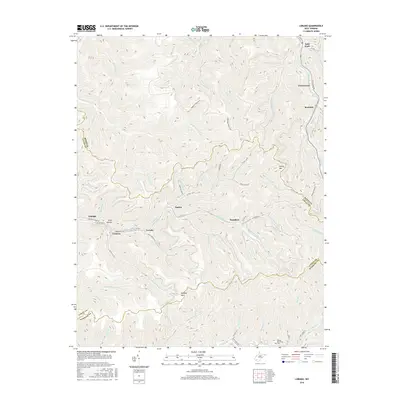
2016 Map of Lorado
USGS Topo · Published 2016About this map
Buffalo Creek winds through a landscape of steep hollows and ridges where the borders of Logan, Boone, and Wyoming Counties meet. This 2016 survey documents the enduring settlement patterns of West Virginia's coal country, centered on communities like Lorado, Craneco, and Lundale. The map traces the intricate transportation network necessary for navigating this terrain, including Buffalo Creek Road and County Highway 16, which connect the small clusters of homes and industrial sites tucked into the valley floors.
Find a feature on this map
65 named features on this map. Tap any name to fly to it.
Don’t see what you’re looking for? This feature index may not catch every label — zoom into the map to look around manually.
Map Details
Editions of this 2016 Lorado Map
This is the sole edition of this map. No revisions or reprints were ever made.
Other maps of this area

1891 · Oceana
USGS Topo · 1:125,000

1893 · Oceana
USGS Topo · 1:125,000

1898 · Oceana
USGS Topo · 1:125,000

1909 · Gilbert
USGS Topo · 1:48,000

1910 · Pineville
USGS Topo · 1:48,000

1910 · Bald Knob
USGS Topo · 1:48,000

1912 · Bald Knob
USGS Topo · 1:62,500

1912 · Gilbert
USGS Topo · 1:62,500

1912 · Pineville
USGS Topo · 1:62,500

1913 · Logan
USGS Topo · 1:62,500