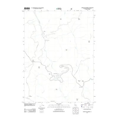
2012 Map of Lord-Ellis Summit
USGS Topo · Published 2012About this map
Lord-Ellis Summit and Berry Summit anchor the high elevations of this Humboldt County terrain, where the headwaters of Redwood Cr and Willow Cr carve through a network of ridges. The landscape is marked by small settlements and resource outposts like Camp Anderson and Redwood Creek Ranch, connected by old winding routes such as Old Dolly Varden Rd and Bair Rd. Geologic and topographic landmarks define the horizon, from the prominent Princess Rock and Circle Point to the high crest of Bald Mountain. Unusual meadow features including Christmas Prairie, Fern Prairie, and Squirrel Tail Ridge indicate localized openings in the forest canopy, while named springs like Pickle Spring and numerous drainages like Toss-up Cr and Noisy Cr reveal the complex hydrology of the northern Coast Ranges.
Find a feature on this map
41 named features on this map. Tap any name to fly to it.
Don’t see what you’re looking for? This feature index may not catch every label — zoom into the map to look around manually.
Map Details
Editions of this 2012 Lord-Ellis Summit Map
This is the sole edition of this map. No revisions or reprints were ever made.
Other maps of this area

1915 · Big Bar and Vicinity
USGS Topo · 1:250,000

1922 · Korbel
USGS Topo · 1:62,500

1922 · China Flat
USGS Topo · 1:62,500

1925 · Hoopa
USGS Topo · 1:125,000

1945 · Coyote Peak
USGS Topo · 1:62,500

1945 · Blue Lake
USGS Topo · 1:62,500

1948 · Weed
USGS Topo · 1:250,000

1950 · Weed
USGS Topo · 1:250,000

1951 · Blue Lake
USGS Topo · 1:62,500

1952 · Willow Creek
USGS Topo · 1:62,500