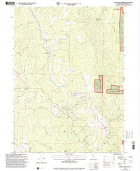
1997 Map of Lord-Ellis Summit
USGS Topo · Published 2001About this map
Redwood Creek defines the central topography of this Humboldt County terrain, carving through the landscape between Wiregrass Ridge and Nixon Ridge. By the late 1990s, this area reflects a blend of protected federal lands and working ranch land. The northern boundary touches the Hoopa Valley Indian Reservation, while much of the surrounding territory is managed within the Six Rivers National Forest. Small-scale human presence is marked by isolated landmarks like the Redwood Creek Ranch and the Camp Anderson (Site) near the water's edge.
Find a feature on this map
49 named features on this map. Tap any name to fly to it.
Don’t see what you’re looking for? This feature index may not catch every label — zoom into the map to look around manually.
Map Details
Editions of this 1997 Lord-Ellis Summit Map
This is the sole edition of this map. No revisions or reprints were ever made.
Other maps of this area

1915 · Big Bar and Vicinity
USGS Topo · 1:250,000

1922 · Korbel
USGS Topo · 1:62,500

1922 · China Flat
USGS Topo · 1:62,500

1925 · Hoopa
USGS Topo · 1:125,000

1945 · Coyote Peak
USGS Topo · 1:62,500

1945 · Blue Lake
USGS Topo · 1:62,500

1948 · Weed
USGS Topo · 1:250,000

1950 · Weed
USGS Topo · 1:250,000

1951 · Blue Lake
USGS Topo · 1:62,500

1952 · Willow Creek
USGS Topo · 1:62,500