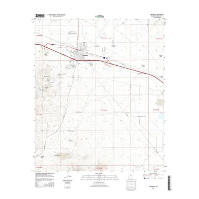
2013 Map of Lordsburg
USGS Topo · Published 2013About this map
Lordsburg serves as a critical desert crossroads in this high-altitude corner of Hidalgo County, defined by its position along major rail and highway corridors. The industrial legacy of the region is anchored by the Lordsburg Coaling Tower-Historic Site, a massive concrete relic of the steam era. To the southwest, the terrain rises into the northern reaches of the Pyramid Mountains, where the older mining settlements of Shakespeare and Valedon are situated. These sites, along with the Shakespeare Cem, offer a glimpse into the earlier boom years of the Silver City region, now bypassed by the modern infrastructure that centers on the city below.
Find a feature on this map
73 named features on this map. Tap any name to fly to it.
Don’t see what you’re looking for? This feature index may not catch every label — zoom into the map to look around manually.
Map Details
Editions of this 2013 Lordsburg Map
This is the sole edition of this map. No revisions or reprints were ever made.
Other maps of this area

1954 · Silver City
USGS Topo · 1:250,000

1958 · Silver City
USGS Topo · 1:250,000

1962 · Silver City
USGS Topo · 1:250,000

1962 · Lisbon
USGS Topo · 1:24,000

1963 · Lordsburg
USGS Topo · 1:24,000

1963 · Gold Hill
USGS Topo · 1:24,000

1963 · Culberson Ranch
USGS Topo · 1:24,000

1964 · Muir Ranch
USGS Topo · 1:24,000

1964 · Pyramid Peak
USGS Topo · 1:24,000

1964 · Gary
USGS Topo · 1:24,000