
1963 Map of Gold Hill
USGS Topo · Published 1965About this map
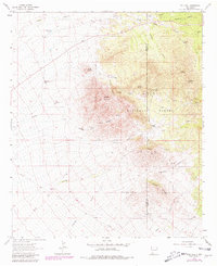
Apache Mountain and the surrounding high desert terrain dominate this mid-century survey of the southwest corner of New Mexico. The landscape is heavily marked by industrial history, particularly within the Gila National Forest, where numerous extraction sites like the Golden Cross Mine, Reservation Mine, and Nancy Lee Mine are documented. This concentration of mines suggests a significant period of prospecting and mineral interest in the mountains north of the Hidalgo and Grant County line.
Find a feature on this map
37 named features on this map. Tap any name to fly to it.
Don’t see what you’re looking for? This feature index may not catch every label — zoom into the map to look around manually.
Map Details
Editions of this 1963 Gold Hill Map
2 editions found
Other maps of this area

1909 · Silver City
USGS Topo · 1:125,000

1950 · Burro Peak
USGS Topo · 1:24,000

1951 · Big Burro Mountains
USGS Topo · 1:24,000

1954 · Silver City
USGS Topo · 1:250,000

1958 · Silver City
USGS Topo · 1:250,000

1959 · Redrock
USGS Topo · 1:62,500

1962 · Silver City
USGS Topo · 1:250,000

1962 · Ninetysix Ranch
USGS Topo · 1:24,000

1962 · Lisbon
USGS Topo · 1:24,000

1963 · Lordsburg
USGS Topo · 1:24,000