
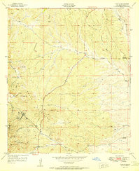
1950 Map of Burro Peak
USGS Topo · Published 1967About this map
Burro Mountains mining activity and ranching life define this high-altitude landscape in the mid-20th century. Centered on Burro Peak, the terrain is marked by numerous extraction sites such as the Star Lode Mine and the Silver Dollar Mine, while others like the Red Hill Turquoise Mine and Austin-Amazon Mines are recorded as inactive by the time of this 1950 field check. The Continental Divide weaves through the eastern portion of the sheet, separating drainage basins and dictating the flow of seasonal waters through Pine Canyon and Deadman Canyon. Evidence of human settlement is found in isolated pockets of industry and agriculture, including the Merry Widow Shaft and family-run operations like the Silsby Ranch and Walking X Ranch. This corner of the Gila National Forest highlights the intersection of mineral prospecting and the hard-scrabble ranching economy of southwestern New Mexico.
Find a feature on this map
40 named features on this map. Tap any name to fly to it.
Don’t see what you’re looking for? This feature index may not catch every label — zoom into the map to look around manually.
Map Details
Editions of this 1950 Burro Peak Map
This is the sole edition of this map. No revisions or reprints were ever made.
Other maps of this area

1909 · Silver City
USGS Topo · 1:125,000

1950 · Tyrone
USGS Topo · 1:24,000

1950 · White Signal
USGS Topo · 1:24,000

1950 · Wind Mountain
USGS Topo · 1:24,000

1951 · White Signal
USGS Topo · 1:24,000

1951 · Big Burro Mountains
USGS Topo · 1:24,000
1951 · Tyrone
USGS Topo · 1:24,000

1951 · Wind Mountain
USGS Topo · 1:24,000

1954 · Silver City
USGS Topo · 1:250,000

1958 · Silver City
USGS Topo · 1:250,000