
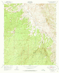
1950 Map of Wind Mountain
USGS Topo · Published 1967About this map
Gila National Forest dominates this landscape, where the high desert terrain is bisected by the Continental Divide. The area shows a clear pattern of mid-century ranching and resource extraction, with family holdings such as Fleming Ranch and Ridout Ranch established near essential water sources like Silver Dale Spring and Mangas Creek. This 1950 field-checked survey reveals an intensive history of prospecting across the Little Burro Mountains, particularly in the southeast corner.
Find a feature on this map
43 named features on this map. Tap any name to fly to it.
Don’t see what you’re looking for? This feature index may not catch every label — zoom into the map to look around manually.
Map Details
Editions of this 1950 Wind Mountain Map
3 editions found
Other maps of this area

1909 · Silver City
USGS Topo · 1:125,000

1949 · Circle Mesa
USGS Topo · 1:24,000

1950 · Tyrone
USGS Topo · 1:24,000

1950 · White Signal
USGS Topo · 1:24,000

1950 · Burro Peak
USGS Topo · 1:24,000

1950 · Silver City
USGS Topo · 1:24,000

1951 · Circle Mesa
USGS Topo · 1:24,000

1951 · White Signal
USGS Topo · 1:24,000
1951 · Silver City
USGS Topo · 1:24,000

1951 · Big Burro Mountains
USGS Topo · 1:24,000