
1949 Map of Circle Mesa
USGS Topo · Published 1966About this map
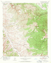
J McMillen Ranch and E McMillen Ranch anchor the southwestern drainage of Mangas Creek in this 1949 field survey of the High Desert. The landscape is defined by the sharp transition from the elevated Circle Mesa and Treasure Mountain down into a complex system of seasonal watercourses. These drainages, including Cottonwood Canyon, Fleming Canyon, and Blacksmith Canyon, reveal a network of ranching outposts reliant on scattered water sources like Cane Spring and Dud Tank. The boundary of the Gila National Forest cuts through the western portion of the map, where early cattle operations like Allison Ranch maintained a Sheep Corral. The topography indicates a remote pastoral economy where movement was dictated by the deep incisions of the canyons and the availability of perennial springs.
Find a feature on this map
30 named features on this map. Tap any name to fly to it.
Don’t see what you’re looking for? This feature index may not catch every label — zoom into the map to look around manually.
Map Details
Editions of this 1949 Circle Mesa Map
2 editions found
Other maps of this area

1909 · Silver City
USGS Topo · 1:125,000

1950 · Tyrone
USGS Topo · 1:24,000

1950 · Dorsey Ranch
USGS Topo · 1:24,000

1950 · Wind Mountain
USGS Topo · 1:24,000

1950 · Silver City
USGS Topo · 1:24,000

1950 · Reading Mountain
USGS Topo · 1:24,000

1951 · Circle Mesa
USGS Topo · 1:24,000

1951 · Dorsey Ranch
USGS Topo · 1:24,000
1951 · Silver City
USGS Topo · 1:24,000
1951 · Tyrone
USGS Topo · 1:24,000