
1950 Map of Silver City
USGS Topo · Published 1968About this map
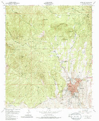
Silver City sits at the base of the high timbered country where the Continental Divide winds through the Pinos Altos Mountains. This 1950 field check captures the town's expansion toward the foothills, showing the Atchison Topeka and Santa Fe railroad terminus and local institutional landmarks like St Marys Academy and the inactive Cottage Sanatorium. The landscape is defined by its mining and geological history, clearly visible in the Quarries at Boston Hill and the expanse of Chloride Flat to the west.
Find a feature on this map
30 named features on this map. Tap any name to fly to it.
Don’t see what you’re looking for? This feature index may not catch every label — zoom into the map to look around manually.
Map Details
Editions of this 1950 Silver City Map
2 editions found
Other maps of this area

1909 · Silver City
USGS Topo · 1:125,000

1947 · Twin Sisters
USGS Topo · 1:24,000

1947 · Fort Bayard
USGS Topo · 1:24,000

1948 · Twin Sisters
USGS Topo · 1:24,000

1949 · Fort Bayard
USGS Topo · 1:24,000

1949 · Hurley West
USGS Topo · 1:24,000

1949 · Circle Mesa
USGS Topo · 1:24,000

1950 · Tyrone
USGS Topo · 1:24,000

1950 · Dorsey Ranch
USGS Topo · 1:24,000

1950 · Wind Mountain
USGS Topo · 1:24,000