
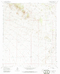
1962 Map of Ninetysix Ranch
USGS Topo · Published 1965About this map
Ninetysix Ranch serves as the focal point of this arid landscape in Grant County, New Mexico, where water management is the primary driver of human settlement. The 1962 survey reveals a complex network of ranching infrastructure, characterized by numerous water sources such as the Pendleton Windmill, Glaze Windmill, and Ash Windmill. Historical transportation routes are prominently represented by the Butterfield Trail, which cuts across the central portion of the map, following the natural contours of the land south of the Garrard Mountains.
Find a feature on this map
23 named features on this map. Tap any name to fly to it.
Don’t see what you’re looking for? This feature index may not catch every label — zoom into the map to look around manually.
Map Details
Editions of this 1962 Ninetysix Ranch Map
2 editions found
Other maps of this area

1954 · Silver City
USGS Topo · 1:250,000

1958 · Silver City
USGS Topo · 1:250,000

1962 · Silver City
USGS Topo · 1:250,000

1962 · Lisbon
USGS Topo · 1:24,000

1963 · Gold Hill
USGS Topo · 1:24,000

1963 · Soldiers Farewell Hill
USGS Topo · 1:24,000
1963 · Werney Hill
USGS Topo · 1:24,000
1963 · C Bar Ranch
USGS Topo · 1:24,000

1964 · Muir Ranch
USGS Topo · 1:24,000
1964 · Separ NE
USGS Topo · 1:24,000