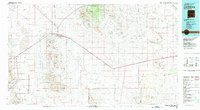
1981 Map of Lordsburg
USGS Topo · Published 1981About this map
The Pyramid Mountains dominate the central landscape of this Southwestern corridor, where mining operations like the Standard Mine and Banner Mine once punctuated the arid terrain. The Southern Pacific rail line and various utility pipelines trace a path through the Lordsburg Valley, connecting the regional hub of Lordsburg to smaller outposts like Road Forks and Separ. This 1981 compilation, based on data from the early 1960s and updated with mid-1970s aerial photography, reveals a landscape defined by water management and mineral extraction. From the northern edge of the Gila National Forest down to Cotton City, the map documents an intricate network of desert drainages including Cienega Creek and Ninetysix Draw. Significant elevations such as South Pyramid Peak and the Cedar Mountain Range hem in the valleys, while the presence of the Phelps Dodge Railroad underscores the enduring importance of industrial transport in Hidalgo County.
Find a feature on this map
108 named features on this map. Tap any name to fly to it.
Don’t see what you’re looking for? This feature index may not catch every label — zoom into the map to look around manually.
Map Details
Editions of this 1981 Lordsburg Map
This is the sole edition of this map. No revisions or reprints were ever made.
Other maps of this area

1899 · Deming
USGS Topo · 1:125,000

1909 · Silver City
USGS Topo · 1:125,000

1915 · Deming
USGS Topo · 1:125,000

1917 · Hermanas
USGS Topo · 1:62,500

1917 · San Simon
USGS Topo · 1:125,000

1917 · Chiricahua
USGS Topo · 1:125,000

1918 · Hachita
USGS Topo · 1:62,500

1918 · Hermanas
USGS Topo · 1:62,500

1918 · Victorio
USGS Topo · 1:62,500

1918 · Playas
USGS Topo · 1:62,500