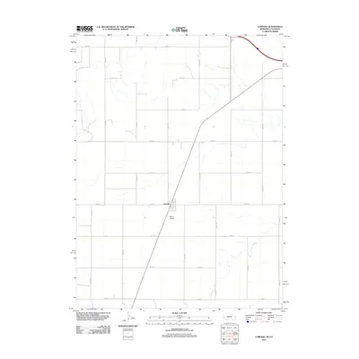
2011 Map of Lorenzo
USGS Topo · Published 2011About this map
Lorenzo sits at the heart of this Cheyenne County landscape, where the high plains of Nebraska meet the Colorado border. The settlement's orderly grid is bisected by a major transit corridor, emphasizing its role as a local crossroads within a vast agricultural framework. The terrain is defined by a rigorous network of section-line roads, including Road 18 and Road 101, which carve the prairie into precise geometric plots. To the south, Cow Creek provides a rare natural break in the landscape's symmetry as it meanders through the southeastern corner. Phelps Airport stands as a notable landmark just south of the main settlement, highlighting the importance of aerial accessibility in this rural expanse. This 2011 survey captures the area at a time when traditional agricultural patterns remained the dominant force in the local economy and spatial organization.
Find a feature on this map
19 named features on this map. Tap any name to fly to it.
Don’t see what you’re looking for? This feature index may not catch every label — zoom into the map to look around manually.
Map Details
Editions of this 2011 Lorenzo Map
This is the sole edition of this map. No revisions or reprints were ever made.
Other maps of this area

1899 · Sidney
USGS Topo · 1:125,000

1951 · Padroni NW
USGS Topo · 1:24,000

1953 · Peetz
USGS Topo · 1:24,000

1953 · Haystack Butte
USGS Topo · 1:24,000

1954 · Sterling
USGS Topo · 1:250,000

1954 · Scottsbluff
USGS Topo · 1:250,000

1958 · Scottsbluff
USGS Topo · 1:250,000

1958 · Sterling
USGS Topo · 1:250,000

1972 · Easterly Airport
USGS Topo · 1:24,000

1972 · Lorenzo
USGS Topo · 1:24,000