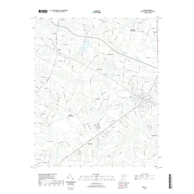
2020 Map of Loris
USGS Topo · Published 2020About this map
Loris serves as the primary hub in this low-lying region of Horry County, where the landscape is defined by an intricate network of wetlands and small farming settlements. The community is clustered around Railroad Ave and is surrounded by numerous family-named bays and swamps, such as Green Sea Bay, Fox Bay, and Pleasant Meadow Swamp. To the south and west, the terrain transitions into significant drainage systems like White Oak Swamp and the aptly named Hellhole Swamp. Small rural centers such as Allsbrook, Sarvis Crossroads, and Green Sea mark the intersections of the county's road network, often centered near local landmarks like the Silent Grove Cem or Patterson Cem. The distribution of these settlements and cemeteries across the agricultural flats between Mitchell Swamp and Kingston Lake illustrates the persistent reliance on high ground in a territory dominated by seasonal waters and broad, forested wetlands.
Find a feature on this map
195 named features on this map. Tap any name to fly to it.
Don’t see what you’re looking for? This feature index may not catch every label — zoom into the map to look around manually.
Map Details
Editions of this 2020 Loris Map
This is the sole edition of this map. No revisions or reprints were ever made.
Other maps of this area

1937 · Nixonville
USGS Topo · 1:48,000

1942 · Nixonville
USGS Topo · 1:62,500

1943 · Adrian
USGS Topo · 1:24,000

1944 · Adrian
USGS Topo · 1:31,680

1948 · Bayboro
USGS Topo · 1:24,000

1949 · Bayboro
USGS Topo · 1:24,000

1949 · Duford
USGS Topo · 1:24,000

1949 · Georgetown
USGS Topo · 1:250,000

1953 · Florence
USGS Topo · 1:250,000

1954 · Florence
USGS Topo · 1:250,000