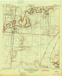
1936 Map of Los Fresnos
USGS Topo · Published 1945About this map
Resaca de los Cuates winds through the heart of this coastal Texas landscape, its tight oxbows defining the local topography and drainage patterns. The map highlights the historic Palo Alto Battlefield in the southern portion, complete with the Palo Alto Battlefield Monument, marking the site of the first major conflict of the Mexican-American War. This 1930s survey records a period of agricultural and infrastructural transition, where irrigation efforts like Main Ditch No 2 and the dry Tule Lake Bed speak to the management of the Rio Grande delta's water resources.
Find a feature on this map
23 named features on this map. Tap any name to fly to it.
Don’t see what you’re looking for? This feature index may not catch every label — zoom into the map to look around manually.
Map Details
Editions of this 1936 Los Fresnos Map
3 editions found

Other maps of this area

1929 · Rio Hondo
USGS Topo · 1:24,000

1929 · La Coma
USGS Topo · 1:24,000

1929 · Palmito Hill
USGS Topo · 1:24,000

1929 · Laguna Vista
USGS Topo · 1:24,000

1930 · Los Fresnos
USGS Topo · 1:24,000

1930 · West Brownsville
USGS Topo · 1:24,000

1930 · Barreda
USGS Topo · 1:24,000

1930 · Laguna Atascosa
USGS Topo · 1:24,000

1930 · East Brownsville
USGS Topo · 1:24,000

1932 · Rio Hondo
USGS Topo · 1:31,680