
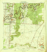
1936 Map of Los Fresnos
USGS Topo · Published 1936About this map
Palo Alto Battlefield anchors the southern portion of this survey, marking a significant historical site with its own Palo Alto Battlefield Monument located just off the Southern Pacific Line. The landscape is defined by the winding course of the Resaca de los Cuates, which meanders through a network of small agricultural settlements like Laureles, Graybill, and Aqua Negra. The town of Los Fresnos is shown as a developing hub along State Highway No 100, served by the Missouri Pacific Line.
Find a feature on this map
23 named features on this map. Tap any name to fly to it.
Don’t see what you’re looking for? This feature index may not catch every label — zoom into the map to look around manually.
Map Details
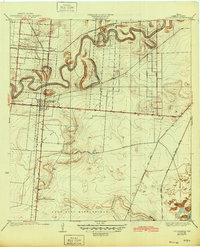
Editions of this 1936 Los Fresnos Map
3 editions found
Other maps of this area

1929 · Rio Hondo
USGS Topo · 1:24,000

1929 · La Coma
USGS Topo · 1:24,000

1929 · Palmito Hill
USGS Topo · 1:24,000

1929 · Laguna Vista
USGS Topo · 1:24,000

1930 · Los Fresnos
USGS Topo · 1:24,000

1930 · West Brownsville
USGS Topo · 1:24,000

1930 · Barreda
USGS Topo · 1:24,000

1930 · Laguna Atascosa
USGS Topo · 1:24,000

1930 · East Brownsville
USGS Topo · 1:24,000

1932 · Rio Hondo
USGS Topo · 1:31,680