Loading...
Loading map...1929 Map of Laguna Vista
USGS Topo · Published 1929About this map
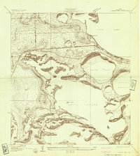
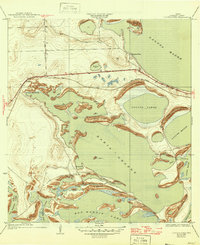
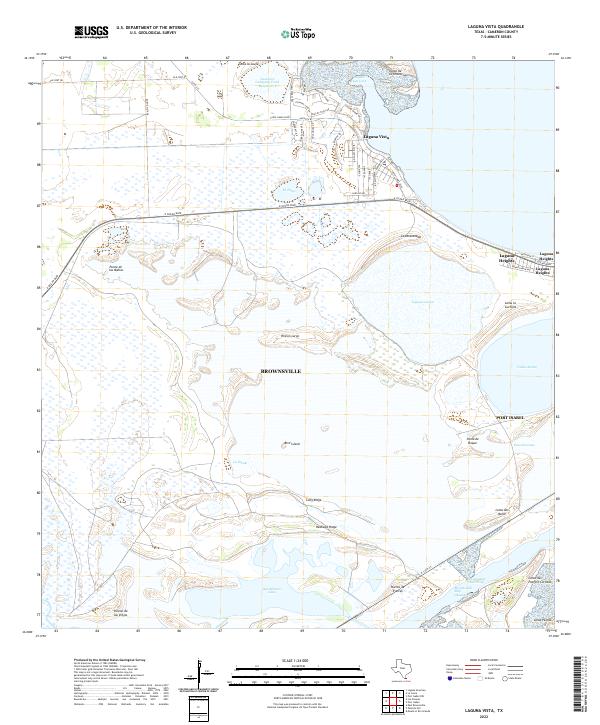
Laguna Madre and the expansive waters of Bahia Grande dominate this 1929 survey of the Texas coast, conducted under the direction of County Judge A. W. Cunningham and Engineer W. O. Washington. The landscape is a complex network of coastal ridges and low-lying wetlands, where the Rio Grande Valley RR cuts through the terrain near the developing settlement of Laguna Vista.
Find a feature on this map
22 named features on this map. Tap any name to fly to it.
Don’t see what you’re looking for? This feature index may not catch every label — zoom into the map to look around manually.
Map Details
Date Portrayed1929
Date Published1929
PublisherU.S. Geological Survey
Map TypeTopographic
Scale1:24,000
Physical Dimensions24.1 x 27 inches
Editions of this 1929 Laguna Vista Map
This is the sole edition of this map. No revisions or reprints were ever made.
Historical Maps of Brownsville Through Time
8 maps found

Featured Locations
Source Details
SourceU.S. Geological Survey
CopyrightPublic Domain