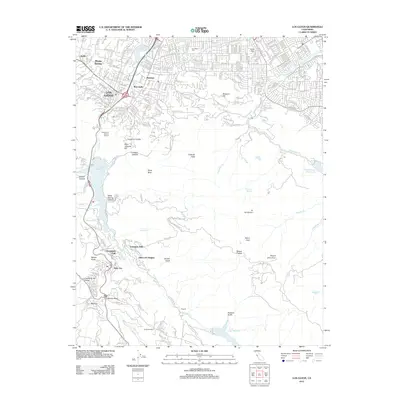
2012 Map of Los Gatos
USGS Topo · Published 2012About this map
The hills of the Santa Cruz Mountains meet the suburban expansion of the Santa Clara Valley in this detailed 2012 study. The town of Los Gatos serves as the focal point, where the urban grid of streets like University Ave and Blossom Hill Rd gives way to the winding paths of the southern highlands. Notable landmarks including Domaine M Marion Winery and Guadalupe College sit nestled near the base of Saint Josephs Hill, illustrating the transition from residential centers to protected open spaces and viticulture.
Find a feature on this map
83 named features on this map. Tap any name to fly to it.
Don’t see what you’re looking for? This feature index may not catch every label — zoom into the map to look around manually.
Map Details
Editions of this 2012 Los Gatos Map
This is the sole edition of this map. No revisions or reprints were ever made.
Other maps of this area

1889 · San Jose
USGS Topo · 1:62,500

1897 · San Jose
USGS Topo · 1:62,500

1897 · Palo Alto
USGS Topo · 1:62,500

1899 · San Jose
USGS Topo · 1:62,500

1899 · Palo Alto
USGS Topo · 1:62,500

1902 · Santa Cruz
USGS Topo · 1:125,000

1916 · New Almaden
USGS Topo · 1:48,000

1919 · New Almaden
USGS Topo · 1:62,500

1940 · Los Gatos
USGS Topo · 1:62,500

1941 · Palo Alto
USGS Topo · 1:62,500