
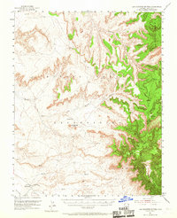
1953 Map of Los Gigantes Buttes
USGS Topo · Published 1956About this map
Navajo Indian Reservation lands in northeastern Arizona are documented here during a period of transition in the early 1950s. The landscape is defined by the massive sandstone formations of Los Gigantes Buttes and the towering heights of the Carrizo Mountains and Lukachukai Mountains. Human presence is concentrated near water sources and travel routes, notably at the Lukachukai Trading Post and the settlement of Round Rock.
Find a feature on this map
20 named features on this map. Tap any name to fly to it.
Don’t see what you’re looking for? This feature index may not catch every label — zoom into the map to look around manually.
Map Details
Editions of this 1953 Los Gigantes Buttes Map
2 editions found
Other maps of this area

1892 · Canyon De Chelly
USGS Topo · 1:250,000

1953 · Los Gigantes NE
USGS Topo · 1:24,000

1953 · Los Gigantes NW
USGS Topo · 1:24,000

1953 · Pastora Peak SW
USGS Topo · 1:24,000

1953 · Redrock Valley SW
USGS Topo · 1:24,000

1953 · Los Gigantes SE
USGS Topo · 1:24,000

1953 · Dinne Mesa SW
USGS Topo · 1:24,000

1953 · Los Gigantes SW
USGS Topo · 1:24,000

1953 · Redrock Valley NW
USGS Topo · 1:24,000

1953 · Dinne Mesa SE
USGS Topo · 1:24,000