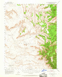
1953 Map of Los Gigantes Buttes
USGS Topo · Published 1967About this map
The Round Rock Trading Post serves as a primary reference point in this mid-century topographic study of the Navajo Indian Reservation in northern Arizona. The landscape is defined by the massive uplift of the Chuska Mountains and the Carrizo Mountains, where deep drainage systems like Mexican Cry Creek and Hasbidito Creek have carved intricate canyon networks. Significant geological features include Los Gigantes Buttes and the distinct profiles of East Mesa and West Mesa.
Find a feature on this map
18 named features on this map. Tap any name to fly to it.
Don’t see what you’re looking for? This feature index may not catch every label — zoom into the map to look around manually.
Map Details
Editions of this 1953 Los Gigantes Buttes Map
2 editions found

Other maps of this area

1892 · Canyon De Chelly
USGS Topo · 1:250,000

1953 · Los Gigantes NE
USGS Topo · 1:24,000

1953 · Los Gigantes NW
USGS Topo · 1:24,000

1953 · Pastora Peak SW
USGS Topo · 1:24,000

1953 · Redrock Valley SW
USGS Topo · 1:24,000

1953 · Los Gigantes SE
USGS Topo · 1:24,000

1953 · Dinne Mesa SW
USGS Topo · 1:24,000

1953 · Los Gigantes SW
USGS Topo · 1:24,000

1953 · Redrock Valley NW
USGS Topo · 1:24,000

1953 · Dinne Mesa SE
USGS Topo · 1:24,000