
1953 Map of Los Gigantes SW
USGS Topo · Published 1954About this map
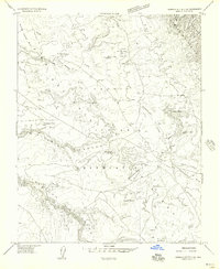
Round Rock Trading Post serves as a focal point in this high-desert landscape within the Navajo Indian Reservation. The geography is defined by significant elevation changes and seasonal watercourses, with Hasbidito Creek and Lukachukai Creek cutting through the terrain. The presence of the Los Gigantes Buttes dominates the northeastern portion of the quadrangle, illustrating the complex erosion patterns of the area. Small-scale water management is evident through features like Hasbidito Spring, several instances of a Dam, and a Ditch near the southern boundary. These early 1950s details provide a view of the infrastructure and natural landmarks essential to life in the Apache County backcountry during this era.
Find a feature on this map
12 named features on this map. Tap any name to fly to it.
Don’t see what you’re looking for? This feature index may not catch every label — zoom into the map to look around manually.
Map Details
Editions of this 1953 Los Gigantes SW Map
This is the sole edition of this map. No revisions or reprints were ever made.
Other maps of this area

1892 · Canyon De Chelly
USGS Topo · 1:250,000

1953 · Los Gigantes NE
USGS Topo · 1:24,000

1953 · Los Gigantes NW
USGS Topo · 1:24,000

1953 · Los Gigantes SE
USGS Topo · 1:24,000

1953 · Los Gigantes Buttes
USGS Topo · 1:62,500

1954 · Shiprock
USGS Topo · 1:250,000

1955 · Sonsala Butte 2 NW
USGS Topo · 1:24,000
1955 · Sonsala Butte 2 NE
USGS Topo · 1:24,000
1955 · Yellowstone Canyon
USGS Topo · 1:62,500

1958 · Shiprock
USGS Topo · 1:250,000