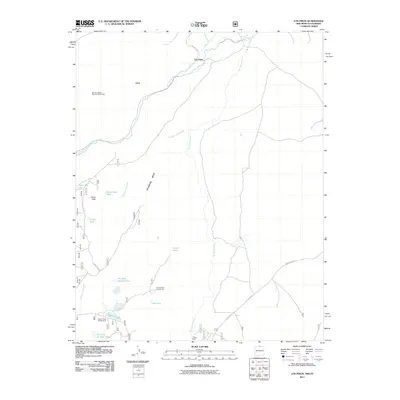
2011 Map of Los Pinos
USGS Topo · Published 2011About this map
Rio de los Pinos and the Rio San Antonio converge in this high-altitude landscape, where the settlement of Los Pinos sits at the northern edge of the quadrangle. The map documents a rugged high-desert environment defined by the wide expanse of Pinabetal Mesa and the volcanic evidence of the Lava flows to the west. Ranching and mining history are visible through features like the T Bone Ranch and Cisnero Mine Number One. Transport and infrastructure are centered around the Big Horn Siding Rail Road Water Tank, a vital relic of the rail network, while the Llano Ditch suggests the historical management of water in this arid region. For those exploring the backcountry, several tanks and the Laguna Larga Campground near Laguna Larga mark the primary points of human presence among the canyons like Cañada los Ranchos.
Find a feature on this map
26 named features on this map. Tap any name to fly to it.
Don’t see what you’re looking for? This feature index may not catch every label — zoom into the map to look around manually.
Map Details
Editions of this 2011 Los Pinos Map
This is the sole edition of this map. No revisions or reprints were ever made.
Other maps of this area

1918 · Tusas
USGS Topo · 1:125,000

1922 · Conejos
USGS Topo · 1:125,000

1945 · Durango
USGS Topo · 1:250,000

1953 · Durango
USGS Topo · 1:250,000

1954 · Durango
USGS Topo · 1:250,000

1954 · Raton
USGS Topo · 1:250,000

1954 · Trinidad
USGS Topo · 1:250,000

1954 · Aztec
USGS Topo · 1:250,000

1955 · Trinidad
USGS Topo · 1:250,000

1958 · Raton
USGS Topo · 1:250,000