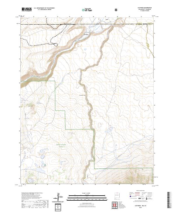
2023 Map of Los Pinos
USGS Topo · Published 2023About this map
Los Pinos and Ortiz sit at the northern edge of this high-altitude landscape, where the border between New Mexico and Colorado is defined by administrative lines rather than terrain. The Rio de los Pinos and Rio San Antonio dominate the drainage patterns, carving through the high mesas of northern Rio Arriba County. Much of the southern and eastern portions of the map are protected within the Río Grande del Norte National Monument and the Carson National Forest, preserving a land marked by significant volcanic and tectonic features like Pinabetal Mesa and Chino Peak. Water management for local ranching is evident through features such as the Llano Ditch and various stock tanks, including Pit Tank Number Two and Chino Peak Tank, which support the high-desert livestock operations that have long characterized this borderland region.
Find a feature on this map
29 named features on this map. Tap any name to fly to it.
Don’t see what you’re looking for? This feature index may not catch every label — zoom into the map to look around manually.
Map Details
Editions of this 2023 Los Pinos Map
This is the sole edition of this map. No revisions or reprints were ever made.
Other maps of this area

1918 · Tusas
USGS Topo · 1:125,000

1922 · Conejos
USGS Topo · 1:125,000

1945 · Durango
USGS Topo · 1:250,000

1953 · Durango
USGS Topo · 1:250,000

1954 · Durango
USGS Topo · 1:250,000

1954 · Raton
USGS Topo · 1:250,000

1954 · Trinidad
USGS Topo · 1:250,000

1954 · Aztec
USGS Topo · 1:250,000

1955 · Trinidad
USGS Topo · 1:250,000

1958 · Raton
USGS Topo · 1:250,000