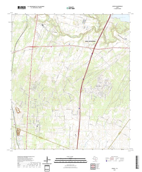
2022 Map of Losoya
USGS Topo · Published 2022About this map
The Medina River meanders through the landscape south of San Antonio, meeting the Sun Antonio River as it flows toward the southeastern corner of Bexar County. This area reflects a deep-rooted rural history, evidenced by family and local burial grounds such as Herrera Cem and the Herrera-Martinez Cem near the community of Losoya. The settlement pattern here is defined by long-established road networks like Spanish Grant Rd and Martinez Losoya Rd, which contrast with the modern expansion of Sandy Oaks to the east. The map captures the hydrological complexity of the basin, where creeks like Palo Blanco Cr and Losoya Cr drain into the primary river systems, while the northern edge is marked by the presence of Braunig Lake. This confluence of waterways and ancestral cemeteries provides a detailed look at the persistence of local lineage in a region increasingly connected to the San Antonio metropolitan corridor.
Find a feature on this map
127 named features on this map. Tap any name to fly to it.
Don’t see what you’re looking for? This feature index may not catch every label — zoom into the map to look around manually.
Map Details
Editions of this 2022 Losoya Map
This is the sole edition of this map. No revisions or reprints were ever made.
Other maps of this area

1953 · Terrell Wells
USGS Topo · 1:24,000

1953 · Elmendorf
USGS Topo · 1:24,000

1953 · Southton
USGS Topo · 1:24,000

1954 · San Antonio
USGS Topo · 1:250,000

1957 · San Antonio
USGS Topo · 1:250,000

1958 · Losoya
USGS Topo · 1:24,000

1958 · Thelma
USGS Topo · 1:24,000

1958 · Saspamco
USGS Topo · 1:24,000
1964 · Saspamco SE
USGS Topo · 1:24,000

1964 · Leming
USGS Topo · 1:24,000