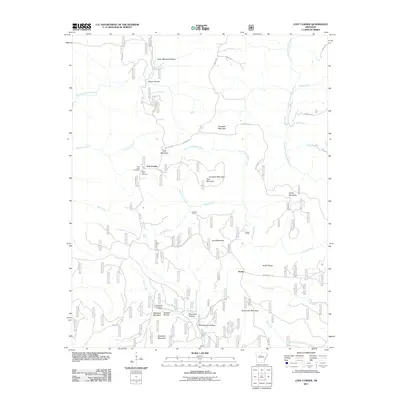
2011 Map of Lost Corner
USGS Topo · Published 2011About this map
Lost Corner and Austin anchor this 2011 topographic survey of the Arkansas interior, a landscape defined by an intricate network of named hollows and ridges. The topography is dominated by numerous high points including Stoebuck Mountain, Kincannon Mountain, and Snowlick Mountain, while the hydrology is shaped by the South Fork Little Red River and Brushy Fork. This map provides a detailed view of the remote rural infrastructure in the early 21st century, showing how modern roads like Dabney Rd and historical routes like the Wilderness Trl navigate the steep relief.
Find a feature on this map
39 named features on this map. Tap any name to fly to it.
Don’t see what you’re looking for? This feature index may not catch every label — zoom into the map to look around manually.
Map Details
Editions of this 2011 Lost Corner Map
This is the sole edition of this map. No revisions or reprints were ever made.
Other maps of this area

1879 · Washington
USGS Topo · 1:62,500

1887 · Smyrna
USGS Topo · 1:62,500

1889 · Marshall #3
USGS Topo · 1:62,500

1892 · Marshall
USGS Topo · 1:125,000

1892 · Morrillton
USGS Topo · 1:125,000

1894 · Morrillton
USGS Topo · 1:125,000

1894 · Marshall
USGS Topo · 1:125,000

1901 · Marshall
USGS Topo · 1:125,000

1940 · Smyrna
USGS Topo · 1:62,500
1943 · Smyrna
USGS Topo · 1:62,500