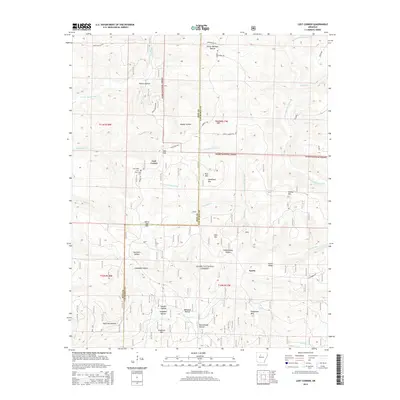
2014 Map of Lost Corner
USGS Topo · Published 2014About this map
Lost Corner and Austin sit within a landscape of deep drainage basins and prominent ridges along the Pope and Van Buren County line. The area is defined by the headwaters of several major waterways, including the E Fork Illinois Bayou in the northwest and the S Fork Little Red River in the northeast. This 2014 survey reveals the complex network of hollows that characterize the Ozark National Forest, such as Victor Millsaps Hollow, Napier Hollow, and Sweden Hollow. Family-named landmarks are frequent across these slopes, from Armstead Mtn and John Mtn to Kincannon Mtn in the southeast. Historical local sites like the New Hope Cem and the descriptive Schoolhouse Hollow provide points of interest for genealogists and local historians tracking the development of these upland communities.
Find a feature on this map
46 named features on this map. Tap any name to fly to it.
Don’t see what you’re looking for? This feature index may not catch every label — zoom into the map to look around manually.
Map Details
Editions of this 2014 Lost Corner Map
This is the sole edition of this map. No revisions or reprints were ever made.
Other maps of this area

1879 · Washington
USGS Topo · 1:62,500

1887 · Smyrna
USGS Topo · 1:62,500

1889 · Marshall #3
USGS Topo · 1:62,500

1892 · Marshall
USGS Topo · 1:125,000

1892 · Morrillton
USGS Topo · 1:125,000

1894 · Morrillton
USGS Topo · 1:125,000

1894 · Marshall
USGS Topo · 1:125,000

1901 · Marshall
USGS Topo · 1:125,000

1940 · Smyrna
USGS Topo · 1:62,500
1943 · Smyrna
USGS Topo · 1:62,500