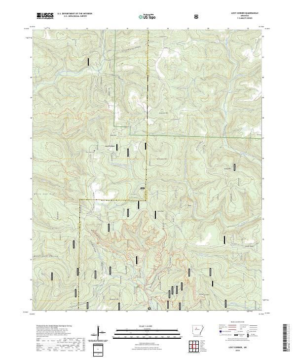
2024 Map of Lost Corner
USGS Topo · Published 2024About this map
Lost Corner sits at the heart of this landscape, positioned where the high ridges of the Ozark National Forest descend into a complex network of hollows and creek beds. The map documents a rugged interior geography along the Pope and Van Buren county line, where family-named landmarks like Victor Millsaps Hollow, Napier Hollow, and Kincannon Mtn reflect generations of settlement. This area is characterized by its hydrological divide, with waters flowing toward the East Fork-Illinois Bayou in the west and the South Fork Little Red River to the east.
Find a feature on this map
68 named features on this map. Tap any name to fly to it.
Don’t see what you’re looking for? This feature index may not catch every label — zoom into the map to look around manually.
Map Details
Editions of this 2024 Lost Corner Map
This is the sole edition of this map. No revisions or reprints were ever made.
Other maps of this area

1879 · Washington
USGS Topo · 1:62,500

1887 · Smyrna
USGS Topo · 1:62,500

1889 · Marshall #3
USGS Topo · 1:62,500

1892 · Marshall
USGS Topo · 1:125,000

1892 · Morrillton
USGS Topo · 1:125,000

1894 · Morrillton
USGS Topo · 1:125,000

1894 · Marshall
USGS Topo · 1:125,000

1901 · Marshall
USGS Topo · 1:125,000

1940 · Smyrna
USGS Topo · 1:62,500
1943 · Smyrna
USGS Topo · 1:62,500