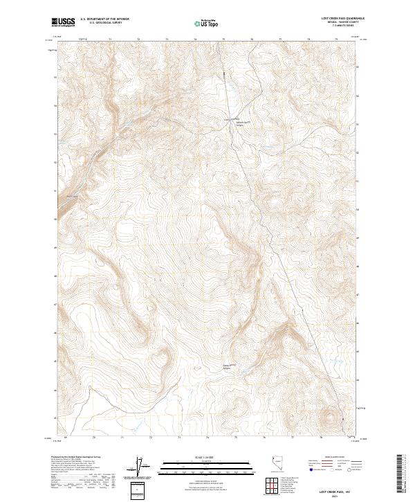
2021 Map of Lost Creek Pass
USGS Topo · Published 2021About this map
Lost Creek Pass stands as the central landmark of this high-desert terrain in Washoe County, where the landscape is defined by its seasonal drainage patterns and springs. The map reveals a remote network of canyons, including Summit Spring Canyon and Sheep Spring Canyon, which provide critical water sources in an otherwise arid environment. Evidence of land management and historical passage is found along Lost Creek Rd, which skirts the Lost Creek Troughs and the topographic bottleneck of Devils Gate. The presence of named water features like Cherry Springs and No Savvy Cr suggests the vital importance of reliable water to ranchers and travelers navigating these Great Basin basins and ranges. The detailed survey captures the intersection of several townships, highlighting the sectioned grid that remains the foundation of land ownership in the Nevada wilderness.
Find a feature on this map
15 named features on this map. Tap any name to fly to it.
Don’t see what you’re looking for? This feature index may not catch every label — zoom into the map to look around manually.
Map Details
Editions of this 2021 Lost Creek Pass Map
This is the sole edition of this map. No revisions or reprints were ever made.
Other maps of this area

1886 · Granite Range
USGS Topo · 1:250,000

1889 · Long Valley
USGS Topo · 1:250,000

1894 · Granite Range
USGS Topo · 1:250,000

1954 · Vya
USGS Topo · 1:250,000

1955 · Lovelock
USGS Topo · 1:250,000

1958 · Vya
USGS Topo · 1:250,000

1959 · Lovelock
USGS Topo · 1:250,000

1962 · Vya
USGS Topo · 1:250,000
1979 · Wall Canyon Reservoir
USGS Topo · 1:24,000
1979 · Chester Lyons Spring
USGS Topo · 1:24,000