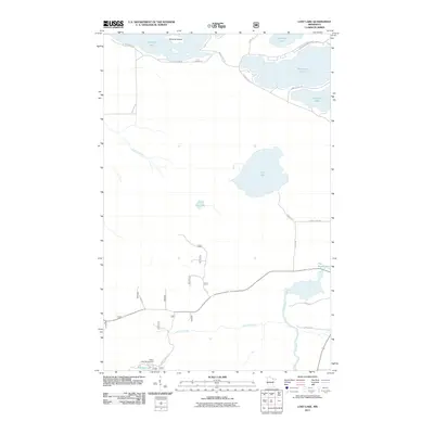
2011 Map of Lost Lake
USGS Topo · Published 2011About this map
Vermilion Lake dominates the northern edge of this Northwoods landscape, where points and islands like Thirtyisx Island define a complex shoreline during the early 21st century. The map illustrates a transition from the larger lake basin into a dense network of smaller interior water bodies and wetlands, including Lost Lake and Little Lost Lake. This area of St. Louis County is characterized by a mix of recreational and residential infrastructure, particularly around the Pfeifer Lake Campground and along shore-hugging routes like Birch Point Rd and Gold Mine Cir. The drainage patterns are clearly marked by the westward flow of the Little Fork River and the meandering course of Lehtinen Creek, which feeds into the Pike River system. Local road names such as Koski Rd and Karjala Rd reflect the heritage of the families who settled this northern Minnesota lake country.
Find a feature on this map
25 named features on this map. Tap any name to fly to it.
Don’t see what you’re looking for? This feature index may not catch every label — zoom into the map to look around manually.
Map Details
Editions of this 2011 Lost Lake Map
This is the sole edition of this map. No revisions or reprints were ever made.
Other maps of this area

1950 · Biwabik NW
USGS Topo · 1:24,000

1950 · Biwabik NE
USGS Topo · 1:24,000

1951 · Biwabik NE
USGS Topo · 1:24,000

1951 · Biwabik NW
USGS Topo · 1:24,000

1951 · Britt
USGS Topo · 1:24,000

1954 · Hibbing
USGS Topo · 1:250,000

1956 · Sioux Pine Island
USGS Topo · 1:24,000

1956 · Tower
USGS Topo · 1:24,000

1956 · Vermilion Dam
USGS Topo · 1:24,000

1956 · Lost Lake
USGS Topo · 1:24,000