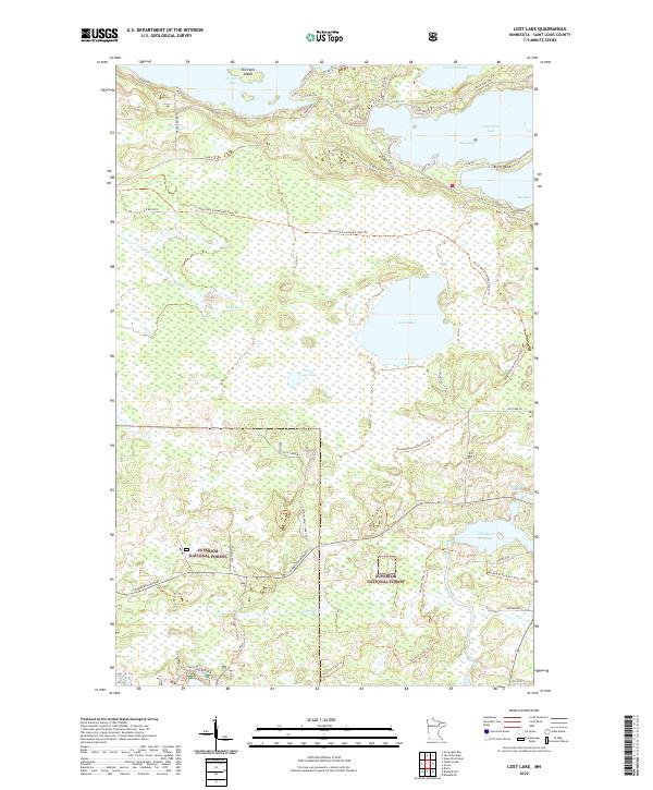
2022 Map of Lost Lake
USGS Topo · Published 2022About this map
Vermilion Lake dominates the northern shoreline of this region, defined by deep bays like Frazer Bay and Daisy Bay alongside the prominent Birch Point. This northern Minnesota landscape is characterized by its transition from open water to the dense wooded wetlands of the Superior National Forest. Modern trails and corridors, such as the David Dill-Arrowhead State Trl and Taconite State Trl, navigate through complex hydrography including the Lost Lake Swamp and the Pike River Flowage. The interior is marked by smaller basins like Lost Lake and Little Lost Lake, while Minnesota Highway 1 provides the primary east-west passage across the southern section. The presence of Gold Mine Cir near the shoreline hints at the area's historical prospecting, while the many county roads serve as access points to the intricate shoreline and recreational forest lands.
Find a feature on this map
48 named features on this map. Tap any name to fly to it.
Don’t see what you’re looking for? This feature index may not catch every label — zoom into the map to look around manually.
Map Details
Editions of this 2022 Lost Lake Map
This is the sole edition of this map. No revisions or reprints were ever made.
Other maps of this area

1950 · Biwabik NW
USGS Topo · 1:24,000

1950 · Biwabik NE
USGS Topo · 1:24,000

1951 · Biwabik NE
USGS Topo · 1:24,000

1951 · Biwabik NW
USGS Topo · 1:24,000

1951 · Britt
USGS Topo · 1:24,000

1954 · Hibbing
USGS Topo · 1:250,000

1956 · Sioux Pine Island
USGS Topo · 1:24,000

1956 · Tower
USGS Topo · 1:24,000

1956 · Vermilion Dam
USGS Topo · 1:24,000

1956 · Lost Lake
USGS Topo · 1:24,000