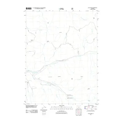
2011 Map of Lost Park
USGS Topo · Published 2011About this map
The North Fork White River carves through this high-elevation landscape in Rio Blanco County, anchoring a network of remote recreation sites and primitive trails. In the southern portion of the quadrangle, Marvine Creek and its tributaries, including Dry Fork Marvine Creek and East Marvine Creek, define the drainage patterns below the massive Big Ridge. The map illustrates a concentration of wilderness access points and seasonal facilities, such as the Marvine Campground and North Fork Campground. This 2011 survey captures the area's transition between alpine meadows like Lost Park and Big Park and the prominent summits of Sand Peak. The presence of established trailheads, including the Ute Creek Trailhead and Long Lost Trailhead, indicates the region's importance for backcountry navigation and modern wilderness management.
Find a feature on this map
39 named features on this map. Tap any name to fly to it.
Don’t see what you’re looking for? This feature index may not catch every label — zoom into the map to look around manually.
Map Details
Editions of this 2011 Lost Park Map
This is the sole edition of this map. No revisions or reprints were ever made.
Other maps of this area

1906 · Grand Hogback
USGS Topo · 1:125,000

1910 · Danforth Hills
USGS Topo · 1:125,000

1910 · Grand Hogback
USGS Topo · 1:125,000

1927 · Glenwood Springs
USGS Topo · 1:125,000

1930 · Glenwood Springs
USGS Topo · 1:125,000

1954 · Craig
USGS Topo · 1:250,000

1957 · Craig
USGS Topo · 1:250,000

1957 · Leadville
USGS Topo · 1:250,000

1958 · Craig
USGS Topo · 1:250,000

1959 · Leadville
USGS Topo · 1:250,000