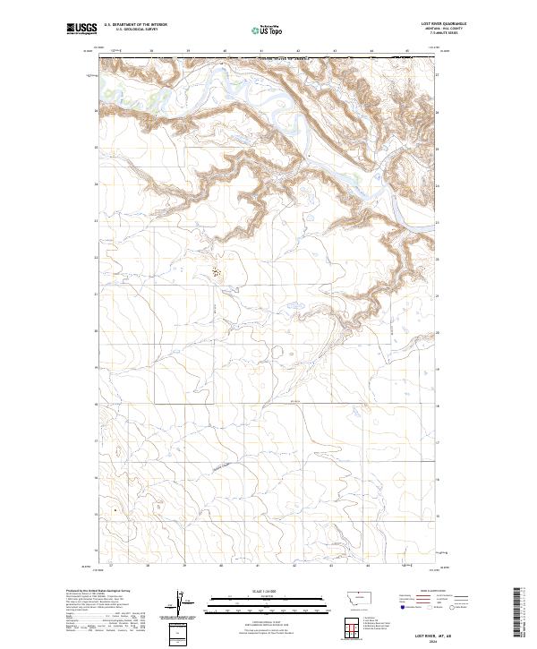
2024 Map of Lost River
USGS Topo · Published 2024About this map
The Milk River meanders through the northern portion of this Hill County landscape, where it is joined by the Lost River near the international boundary with the United States of America. This northern Montana terrain is defined by its drainage patterns and the deep incision of the Sahara Coulee further south. The map reflects a rural, open landscape structured by the Public Land Survey System, with township and range lines such as t37n r10e and t36n r9e providing the primary spatial framework. Modern section-line roads, including Rd 135 N and Rd 240 N, offer access across the vast tracts of land between these significant watercourses. The convergence of these two rivers and the surrounding coulees illustrates a remote northern environment where hydrology and property boundaries dictate the human imprint on the land.
Find a feature on this map
11 named features on this map. Tap any name to fly to it.
Don’t see what you’re looking for? This feature index may not catch every label — zoom into the map to look around manually.
Map Details
Editions of this 2024 Lost River Map
This is the sole edition of this map. No revisions or reprints were ever made.
Other maps of this area

1919 · Alma
USGS Topo · 1:125,000

1920 · Gildford
USGS Topo · 1:125,000

1943 · Gildford
USGS Topo · 1:125,000

1954 · Shelby
USGS Topo · 1:250,000

1958 · Shelby
USGS Topo · 1:250,000
1972 · Lost River NE
USGS Topo · 1:24,000

1972 · Mc Kinnsey Reservoir East
USGS Topo · 1:24,000

1972 · Mc Kinnsey Reservoir West
USGS Topo · 1:24,000
1972 · Ninemile Coulee West
USGS Topo · 1:24,000
1972 · Lost River
USGS Topo · 1:24,000