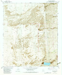
1982 Map of Lost River
USGS Topo · Published 1982About this map
Holloman Air Force Base dominates the eastern desert of Otero County in this early 1980s orthophotomap, which utilizes aerial imagery to show the stark contrast between human infrastructure and the desert floor. The most prominent feature is the High Speed Test Track, a linear engineering marvel running north-south through the base. To the west, the landscape shifts into the White Sands Missile Range, characterized by expansive areas of shifting sand. Small markers of human occupation and scientific monitoring appear throughout the arid environment, including the Danley Well, the Pritch Site, and several Observation Towers. Hydrological patterns are defined by the Lost River and drainages like Hay Draw and Sheep Camp Draw, which cut through the basin. This map captures the intersection of mid-century military aerospace testing and the active desert geology of New Mexico.
Find a feature on this map
16 named features on this map. Tap any name to fly to it.
Don’t see what you’re looking for? This feature index may not catch every label — zoom into the map to look around manually.
Map Details
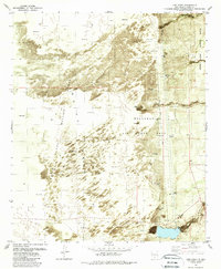
Editions of this 1982 Lost River Map
2 editions found
Other maps of this area

1916 · Tularosa
USGS Topo · 1:125,000

1916 · Point Of Sands
USGS Topo · 1:125,000

1947 · Point Of Sands 2
USGS Topo · 1:62,500

1948 · Lumley Lake
USGS Topo · 1:62,500

1948 · Tularosa
USGS Topo · 1:62,500

1948 · Holloman
USGS Topo · 1:62,500

1954 · Tularosa
USGS Topo · 1:250,000

1955 · Las Cruces
USGS Topo · 1:250,000

1958 · Las Cruces
USGS Topo · 1:250,000

1958 · Tularosa
USGS Topo · 1:250,000