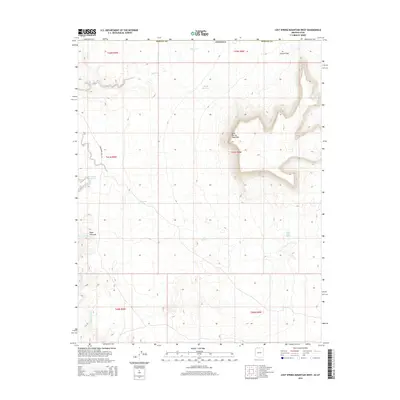
2014 Map of Lost Spring Mountain West
USGS Topo · Published 2014About this map
Lost Spring Mountain dominates the central topography of this Mohave County landscape, where water remains the defining element of the high desert. This 2014 survey documents a network of vital water sources, from the Reeds Reservoir in the north to the Clayhole Wash drainage system in the southwest. The presence of the Honeymoon Trail Rd suggests the historical movement of people through this arid corridor, linking several small springs that were essential for travelers and livestock. Small, dispersed water points such as Antelope Spring, Cottonwood Spring, and Lytle Spring illustrate the precarious nature of life and transport in this part of Arizona. In the northeast, the terrain breaks at Canaan Gap, providing a natural passage through the elevated ridges.
Find a feature on this map
19 named features on this map. Tap any name to fly to it.
Don’t see what you’re looking for? This feature index may not catch every label — zoom into the map to look around manually.
Map Details
Editions of this 2014 Lost Spring Mountain West Map
This is the sole edition of this map. No revisions or reprints were ever made.
Other maps of this area

1885 · St. George
USGS Topo · 1:250,000

1886 · Mt. Trumbull
USGS Topo · 1:250,000

1891 · St. George
USGS Topo · 1:250,000

1892 · Mt. Trumbull
USGS Topo · 1:250,000

1953 · Cedar City
USGS Topo · 1:250,000

1953 · Grand Canyon
USGS Topo · 1:250,000

1954 · La Verkin 4 SE
USGS Topo · 1:24,000

1954 · La Verkin 4 SW
USGS Topo · 1:24,000

1954 · Lost Spring SE
USGS Topo · 1:24,000

1954 · Hurricane Cliffs 2 NE
USGS Topo · 1:24,000