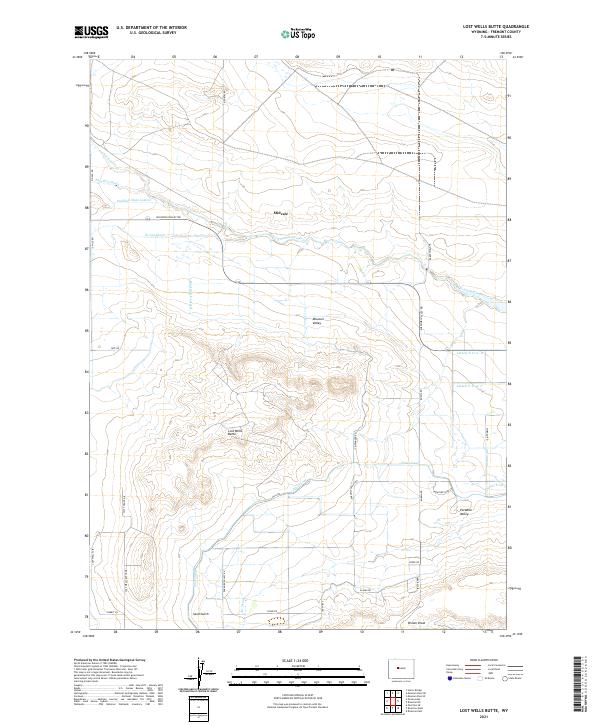
2021 Map of Lost Wells Butte
USGS Topo · Published 2021About this map
Midvale serves as a central hub in this portion of Fremont County, situated within a landscape heavily defined by its sophisticated water management systems. The extensive network of the Pilot Canal, Pavillion Main Lateral, and numerous secondary channels like Lateral P-27.0- D illustrates the transformation of this arid region into productive agricultural land. These irrigation features crisscross Missouri Valley, supporting small clusters of development in areas like Paradise Valley.
Find a feature on this map
42 named features on this map. Tap any name to fly to it.
Don’t see what you’re looking for? This feature index may not catch every label — zoom into the map to look around manually.
Map Details
Editions of this 2021 Lost Wells Butte Map
This is the sole edition of this map. No revisions or reprints were ever made.
Other maps of this area

1950 · Riverton East
USGS Topo · 1:24,000

1950 · Harris Bridge
USGS Topo · 1:24,000

1950 · Mexican Pass SW
USGS Topo · 1:24,000

1950 · Ocean Lake
USGS Topo · 1:24,000

1951 · Mexican Pass SE
USGS Topo · 1:24,000

1951 · Pavillion SE
USGS Topo · 1:24,000

1951 · Riverton West
USGS Topo · 1:24,000

1952 · Riverton NE
USGS Topo · 1:24,000

1952 · Lost Wells Butte
USGS Topo · 1:24,000

1955 · Thermopolis
USGS Topo · 1:250,000