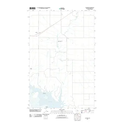
2011 Map of Lothair
USGS Topo · Published 2011About this map
Lothair sits along the northern edge of this Liberty County landscape, organized around a tight grid of streets including Main St and Central Ave. The surrounding terrain is defined by the significant presence of Lake Elwell to the south, where the Willow Creek Campground serves as a point of recreation along the shoreline. The land is marked by distinct geological features such as Carter Coulee and Emerson Coulee, showcasing the erosion patterns typical of this Montana region.
Find a feature on this map
14 named features on this map. Tap any name to fly to it.
Don’t see what you’re looking for? This feature index may not catch every label — zoom into the map to look around manually.
Map Details
Editions of this 2011 Lothair Map
This is the sole edition of this map. No revisions or reprints were ever made.
Other maps of this area

1954 · Shelby
USGS Topo · 1:250,000

1958 · Shelby
USGS Topo · 1:250,000

1962 · Tiber
USGS Topo · 1:24,000

1962 · North Lothair School
USGS Topo · 1:24,000

1962 · Mc Carters Lake SE
USGS Topo · 1:24,000

1970 · Sagebrush Coulee
USGS Topo · 1:24,000

1970 · Pondera School
USGS Topo · 1:24,000

1970 · Galata
USGS Topo · 1:24,000

1970 · Lothair SW
USGS Topo · 1:24,000
1970 · Lothair
USGS Topo · 1:24,000