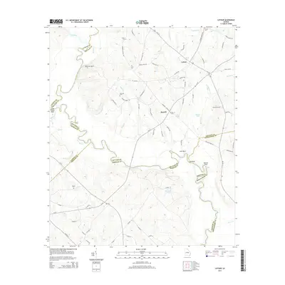
2014 Map of Lothair
USGS Topo · Published 2014About this map
The Oconee River winds through this Georgia landscape, serving as a natural boundary where Treutlen, Laurens, and Wheeler counties converge. This riverine environment is defined by distinctive elevations such as Berry Hill Bluff and Bonnie Clabber Bluff, overlooking a network of creeks including Buck Cr and Pitts Cr. The map preserves several historical markers of interest to genealogists, most notably the Gov Troup Grave and several community burial grounds like Beulah Cem and Barnhill Cem. The small settlements of Lothair and Barnhill anchor the local road network, which includes colorfully named routes like Cotton Pickin Rd and Hummingbird Ln. Evidence of rural industry and local transport appears through Cauley's Airstrip and the numerous small ponds like Lake Ginger and Barwick Pond that dot the area east of the river.
Find a feature on this map
80 named features on this map. Tap any name to fly to it.
Don’t see what you’re looking for? This feature index may not catch every label — zoom into the map to look around manually.
Map Details
Editions of this 2014 Lothair Map
This is the sole edition of this map. No revisions or reprints were ever made.
Other maps of this area

1957 · Macon
USGS Topo · 1:250,000

1958 · Macon
USGS Topo · 1:250,000

1964 · Macon
USGS Topo · 1:250,000

1970 · Glenwood
USGS Topo · 1:24,000

1970 · Alamo
USGS Topo · 1:24,000

1970 · Mount Vernon
USGS Topo · 1:24,000

1971 · Soperton South
USGS Topo · 1:24,000

1971 · Soperton North
USGS Topo · 1:24,000

1971 · Lothair
USGS Topo · 1:24,000

1971 · Rockledge
USGS Topo · 1:24,000