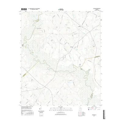
2017 Map of Lothair
USGS Topo · Published 2017About this map
The Oconee River meanders through this portion of Treutlen County, defining the boundary with Laurens County and Wheeler County to the west. The river's path is marked by high points and traditional river landmarks such as Berry Hill Bluff, Bonnie Clabber Bluff, and Silver Bluff. In the center of the sheet, the Gov Troup Grave sits near the headwaters of Boggy Br, providing a significant touchstone for regional history. The settlements of Lothair and Barnhill serve as the primary hubs, connected by a network of rural routes like Cotton Picking Rd and Troups Tomb Rd. For genealogists, the map preserves the locations of several family-named burial sites including Joyce Cem, Cooper Cem, and Fowlers Cem. The landscape is a complex of wetlands and oxbow formations, including Horseshoe Pond and the Dead River, which illustrate the shifting course of the Oconee over time.
Find a feature on this map
83 named features on this map. Tap any name to fly to it.
Don’t see what you’re looking for? This feature index may not catch every label — zoom into the map to look around manually.
Map Details
Editions of this 2017 Lothair Map
This is the sole edition of this map. No revisions or reprints were ever made.
Other maps of this area

1957 · Macon
USGS Topo · 1:250,000

1958 · Macon
USGS Topo · 1:250,000

1964 · Macon
USGS Topo · 1:250,000

1970 · Glenwood
USGS Topo · 1:24,000

1970 · Alamo
USGS Topo · 1:24,000

1970 · Mount Vernon
USGS Topo · 1:24,000

1971 · Soperton South
USGS Topo · 1:24,000

1971 · Soperton North
USGS Topo · 1:24,000

1971 · Lothair
USGS Topo · 1:24,000

1971 · Rockledge
USGS Topo · 1:24,000