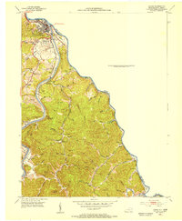
1953 Map of Louisa
USGS Topo · Published 1955About this map
The confluence of the Big Sandy River, Tug Fork, and Levisa Fork shapes this 1953 landscape, centered on the town of Louisa. As a vital transit corridor, the area is defined by the Chesapeake and Ohio railroad which follows the winding riverbanks. The settlement pattern is deeply rooted in the hollows and along the forks, where numerous family-named landmarks like Preece Cem and Emerson-Stratton Cem provide significant genealogical value. Small mountain communities and rural outposts such as Walbridge, Torchlight, and Clifford are documented during a period of active local industry, evidenced by multiple Oil Wells and a scattered network of country schoolhouses like Donithon Sch. The presence of several historic churches, including Elizabeth Jarrell Ch and Emily Northrup Ch, reflects the social fabric of Lawrence County in the mid-20th century.
Find a feature on this map
88 named features on this map. Tap any name to fly to it.
Don’t see what you’re looking for? This feature index may not catch every label — zoom into the map to look around manually.
Map Details
Editions of this 1953 Louisa Map
This is the sole edition of this map. No revisions or reprints were ever made.
Other maps of this area

1886 · Prestonsburg
USGS Topo · 1:125,000

1887 · Warfield
USGS Topo · 1:125,000

1891 · Warfield
USGS Topo · 1:125,000

1892 · Prestonsburg
USGS Topo · 1:125,000

1892 · Huntington
USGS Topo · 1:125,000

1898 · Huntington
USGS Topo · 1:125,000

1903 · Kenova
USGS Topo · 1:125,000

1904 · Kenova
USGS Topo · 1:125,000

1909 · Wayne
USGS Topo · 1:62,500

1910 · Naugatuck
USGS Topo · 1:48,000