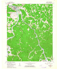
1962 Map of Louisa
USGS Topo · Published 1963About this map
Louisa, Kentucky, and Fort Gay, West Virginia, sit at the strategic confluence where the Tug Fork and Levisa Fork join to form the Big Sandy River. This 1962 survey illustrates the vital rail and river corridor shared by Lawrence County and Wayne County, dominated by the routes of the Chesapeake and Ohio and Norfolk and Western railroads. Away from the river banks, the terrain is defined by complex ridges such as Watts Ridge and Pine Ridge, where numerous family cemeteries like Hinkle Cem and Frasher Cem are tucked into the hollows. The presence of several rural institutions, including Mill Creek Sch and Bartram Chapel, suggests a landscape of small, self-contained upland communities like Saltpetre and Glenhayes that remained largely distinct from the industrial activity of the lowland rail junctions and the prominent Lookout Tower on Pine Hill.
Find a feature on this map
121 named features on this map. Tap any name to fly to it.
Don’t see what you’re looking for? This feature index may not catch every label — zoom into the map to look around manually.
Map Details
Editions of this 1962 Louisa Map
This is the sole edition of this map. No revisions or reprints were ever made.
Other maps of this area

1886 · Prestonsburg
USGS Topo · 1:125,000

1887 · Warfield
USGS Topo · 1:125,000

1891 · Warfield
USGS Topo · 1:125,000

1892 · Prestonsburg
USGS Topo · 1:125,000

1892 · Huntington
USGS Topo · 1:125,000

1898 · Huntington
USGS Topo · 1:125,000

1903 · Kenova
USGS Topo · 1:125,000

1904 · Kenova
USGS Topo · 1:125,000

1909 · Wayne
USGS Topo · 1:62,500

1910 · Naugatuck
USGS Topo · 1:48,000