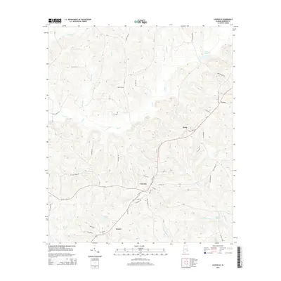
2014 Map of Louisville
USGS Topo · Published 2014About this map
Louisville serves as the central hub of this Barbour County landscape, where the confluence of several local roads including Al-51 and Al-130 meet. The area is defined by its intricate drainage networks, with Pea Cr and its numerous tributaries like Beaver Br and Long Br carving through the terrain. For those researching local family history, the map identifies specific rural points of interest such as the Mt Zion Cem near Baxters, and the small community at Hobdy.
Find a feature on this map
59 named features on this map. Tap any name to fly to it.
Don’t see what you’re looking for? This feature index may not catch every label — zoom into the map to look around manually.
Map Details
Editions of this 2014 Louisville Map
This is the sole edition of this map. No revisions or reprints were ever made.
Other maps of this area

1953 · Dothan
USGS Topo · 1:250,000

1954 · Dothan
USGS Topo · 1:250,000

1955 · Dothan
USGS Topo · 1:250,000

1967 · Clayton South
USGS Topo · 1:24,000

1968 · Clayton North
USGS Topo · 1:24,000

1968 · Perote
USGS Topo · 1:24,000

1968 · Louisville
USGS Topo · 1:24,000
1968 · Josie
USGS Topo · 1:24,000

1968 · Mount Andrew
USGS Topo · 1:24,000
1969 · Elamville
USGS Topo · 1:24,000