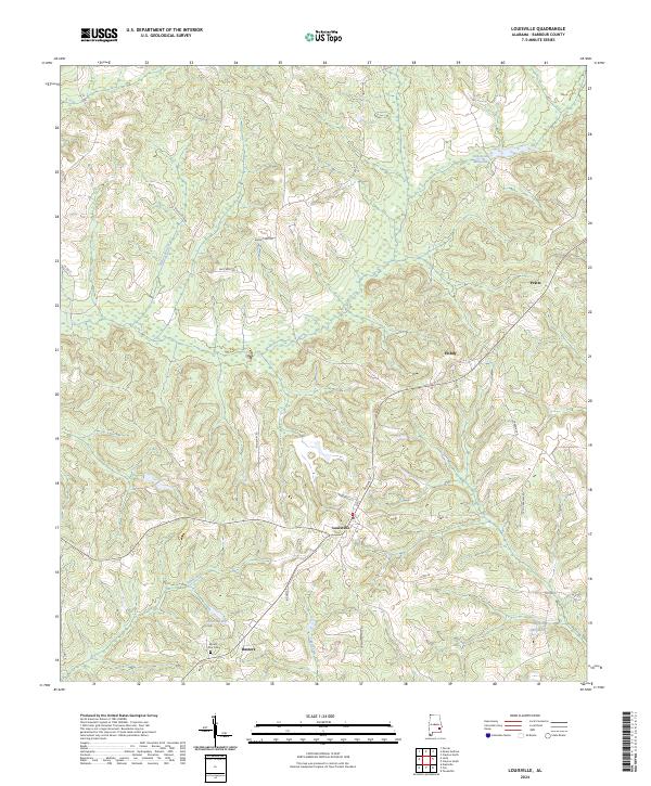
2024 Map of Louisville
USGS Topo · Published 2024About this map
Louisville serves as the central hub for this portion of Barbour County, with its grid of streets like Magnolia St and N Main St radiating from the town center. The surrounding landscape is defined by a dense network of water features and small rural settlements, reflecting a long history of water-powered industry and family farming. Evidence of this past is found at Robertson Millpond in the north and Haglers Millpond in the southeast, indicating where local milling operations once shaped the economy. The terrain is marked by numerous watercourses including Beaver Branch and Sand Creek. For genealogists, the Mount Zion Cem near Baxters provides a critical point of interest, while other small community clusters like Hobdy and Pratts illustrate the enduring pattern of rural Barbour County life.
Find a feature on this map
31 named features on this map. Tap any name to fly to it.
Don’t see what you’re looking for? This feature index may not catch every label — zoom into the map to look around manually.
Map Details
Editions of this 2024 Louisville Map
This is the sole edition of this map. No revisions or reprints were ever made.
Other maps of this area

1953 · Dothan
USGS Topo · 1:250,000

1954 · Dothan
USGS Topo · 1:250,000

1955 · Dothan
USGS Topo · 1:250,000

1967 · Clayton South
USGS Topo · 1:24,000

1968 · Clayton North
USGS Topo · 1:24,000

1968 · Perote
USGS Topo · 1:24,000

1968 · Louisville
USGS Topo · 1:24,000
1968 · Josie
USGS Topo · 1:24,000

1968 · Mount Andrew
USGS Topo · 1:24,000
1969 · Elamville
USGS Topo · 1:24,000