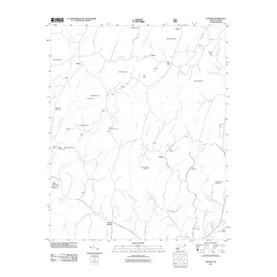
2011 Map of Lovejoy
USGS Topo · Published 2011About this map
The Uwharrie Mountains foothills define this landscape, where family settlements and timber camps have long coexisted with the creeks that drain toward the Yadkin-Pee Dee basin. Small communities like Ophir, Abner, and Lovejoy are central to this 2011 survey, reflecting a history of rural self-sufficiency in Montgomery County. High points such as Dark Mountain and Flint Hill overlook a network of seasonal camps and hunting grounds, including the East Morris Mountain Hunt Camp. Significant local history is preserved at the Zoar Cemetery and Shiloh Cemetery, which stand alongside institutional sites like the State Prison Camp 804. The drainage pattern is complex, with Dumas Creek, Barnes Creek, and Spencer Creek carving through the terrain. The presence of the Buck Mountain Lookout Tower emphasizes the area's ongoing importance as managed forest land.
Find a feature on this map
86 named features on this map. Tap any name to fly to it.
Don’t see what you’re looking for? This feature index may not catch every label — zoom into the map to look around manually.
Map Details
Editions of this 2011 Lovejoy Map
This is the sole edition of this map. No revisions or reprints were ever made.
Other maps of this area

1942 · Troy
USGS Topo · 1:125,000

1953 · Raleigh
USGS Topo · 1:250,000

1953 · Charlotte
USGS Topo · 1:250,000

1954 · Charlotte
USGS Topo · 1:250,000

1954 · Raleigh
USGS Topo · 1:250,000

1957 · Albemarle
USGS Topo · 1:62,500

1957 · Denton
USGS Topo · 1:62,500

1957 · Troy
USGS Topo · 1:62,500

1957 · Asheboro
USGS Topo · 1:62,500

1960 · Charlotte
USGS Topo · 1:250,000