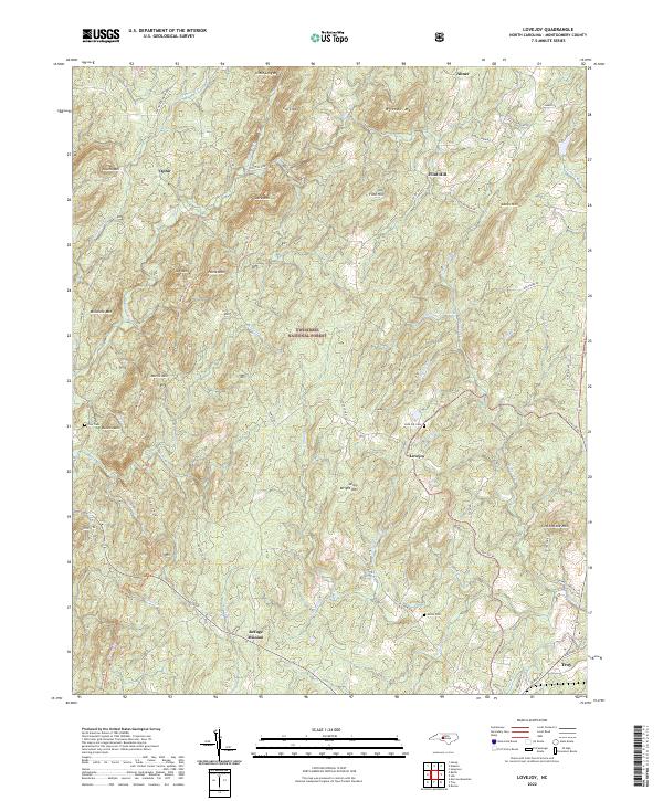
2022 Map of Lovejoy
USGS Topo · Published 2022About this map
Uwharrie National Forest dominates this section of the Uwharrie Mountains, where modern conservation efforts protect a landscape defined by sharp ridges and winding creeks. The settlement of Lovejoy sits centrally along Love Joy Rd, anchored by the Love Joy Cem and the nearby Shiloh Cem. This topography, characterized by peaks like Jenny Wright Mtn and Cottontone Mtn, historically influenced the isolated development of communities such as Ophir, Abner, and Flint Hill. While the southern edge reveals the outskirts of Troy, much of the terrain remains dedicated to natural preservation, evidenced by the Uwharrie Nrt Trl threading through Morris Mtn and Horse Mtn. The intricate drainage patterns of Barnes Cr and Dumas Cr demonstrate how the area's hydrology continues to shape its road network and rural homesteads.
Find a feature on this map
68 named features on this map. Tap any name to fly to it.
Don’t see what you’re looking for? This feature index may not catch every label — zoom into the map to look around manually.
Map Details
Editions of this 2022 Lovejoy Map
This is the sole edition of this map. No revisions or reprints were ever made.
Other maps of this area

1942 · Troy
USGS Topo · 1:125,000

1953 · Raleigh
USGS Topo · 1:250,000

1953 · Charlotte
USGS Topo · 1:250,000

1954 · Charlotte
USGS Topo · 1:250,000

1954 · Raleigh
USGS Topo · 1:250,000

1957 · Albemarle
USGS Topo · 1:62,500

1957 · Denton
USGS Topo · 1:62,500

1957 · Troy
USGS Topo · 1:62,500

1957 · Asheboro
USGS Topo · 1:62,500

1960 · Charlotte
USGS Topo · 1:250,000