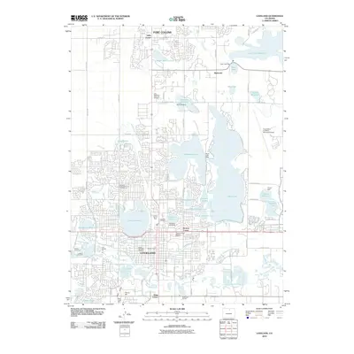
2010 Map of Loveland
USGS Topo · Published 2010About this map
Loveland and the southern edge of Fort Collins dominate this suburban and industrial corridor at the foot of the Colorado Front Range. The landscape is defined by an extensive water management network, including the Loveland and Greeley Canal, Farmers Ditch, and Louden Ditch, which feed a series of reservoirs like Lake Loveland, Boyd Lake, and Fossil Creek Reservoir. Industrial activity is evident in the numerous extraction sites along the Big Thompson River corridor, such as the Say Hawker Pit and the Loveland Gravel Pit. The local agricultural processing history is represented by the Loveland Sugar Refinery, while modern infrastructure is anchored by the Fort Collins-Loveland Municipal Airport. Residential growth is interspersed with older local landmarks like Trilby Corner and Hollowell Corner, alongside several large cemeteries serving the expanding population centers.
Find a feature on this map
95 named features on this map. Tap any name to fly to it.
Don’t see what you’re looking for? This feature index may not catch every label — zoom into the map to look around manually.
Map Details
Editions of this 2010 Loveland Map
This is the sole edition of this map. No revisions or reprints were ever made.
Other maps of this area

1902 · Greeley
USGS Topo · 1:125,000

1906 · Loveland
USGS Topo · 1:62,500

1906 · Fort Collins
USGS Topo · 1:62,500

1907 · Livermore
USGS Topo · 1:125,000

1908 · Loveland
USGS Topo · 1:62,500

1908 · Fort Collins
USGS Topo · 1:62,500

1908 · Eaton
USGS Topo · 1:125,000

1909 · Livermore
USGS Topo · 1:125,000

1910 · Eaton
USGS Topo · 1:125,000

1950 · Windsor
USGS Topo · 1:24,000