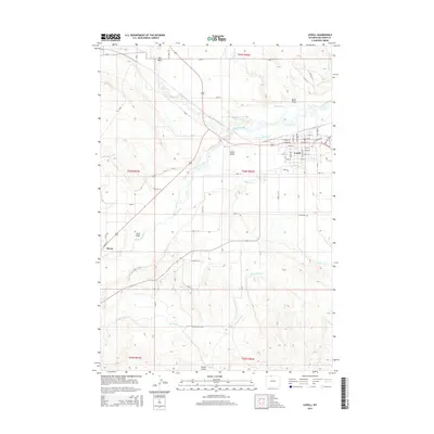
2015 Map of Lovell
USGS Topo · Published 2015About this map
The Shoshone River bisects this landscape, shaping the development of Lovell and Byron in Big Horn County. The intricate network of irrigation systems, including the Hunt Godfrey Canal, Globe Canal, and the Elk-Lovell Canal, illustrates the heavy reliance on water management for agriculture in this high desert region. These canals trace the contours of the land, diverting water from the river to sustain the surrounding plains. To the north and south, the terrain is defined by dramatic drainage features such as Foster Gulch, Sand Draw, and Black Draw. Local history is anchored by the Lovell Cem and a detailed grid of rural roads like Lane 10 and CR-11, which connect the town centers to the outlying homesteads and industrial sites near the riverbanks.
Find a feature on this map
60 named features on this map. Tap any name to fly to it.
Don’t see what you’re looking for? This feature index may not catch every label — zoom into the map to look around manually.
Map Details
Editions of this 2015 Lovell Map
This is the sole edition of this map. No revisions or reprints were ever made.
Other maps of this area

1955 · Cody
USGS Topo · 1:250,000

1958 · Cody
USGS Topo · 1:250,000

1962 · Cody
USGS Topo · 1:250,000

1964 · Lovell Lakes
USGS Topo · 1:24,000

1964 · Sykes Spring
USGS Topo · 1:24,000

1966 · Gilmore Hill NE
USGS Topo · 1:24,000

1966 · North Emblem Reservoir
USGS Topo · 1:24,000

1966 · Frannie
USGS Topo · 1:24,000

1966 · Cowley
USGS Topo · 1:24,000

1966 · Jack Horner Reservoir
USGS Topo · 1:24,000