
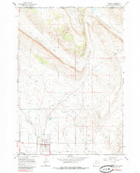
1966 Map of Cowley
USGS Topo · Published 1969About this map
The town of Cowley serves as the focal point of this Big Horn County landscape, captured during a period of steady agricultural and aviation development. The mapping reveals a complex irrigation system vital to the arid region, featuring the Sidon Canal and Lateral D-56 moving water across the plains. Local infrastructure is well-defined, from the Lovell-Cowley-Byron Airport and its accompanying Airway Beacon to the Rodeo Ground on the edge of town.
Find a feature on this map
21 named features on this map. Tap any name to fly to it.
Don’t see what you’re looking for? This feature index may not catch every label — zoom into the map to look around manually.
Map Details
Editions of this 1966 Cowley Map
3 editions found
Other maps of this area

1954 · Billings
USGS Topo · 1:250,000

1955 · Cody
USGS Topo · 1:250,000

1957 · Billings
USGS Topo · 1:250,000

1958 · Billings
USGS Topo · 1:250,000

1958 · Cody
USGS Topo · 1:250,000

1962 · Cody
USGS Topo · 1:250,000

1964 · Red Pryor Mountain
USGS Topo · 1:24,000

1964 · Lovell Lakes
USGS Topo · 1:24,000

1964 · Sykes Spring
USGS Topo · 1:24,000
1964 · Mystery Cave
USGS Topo · 1:24,000