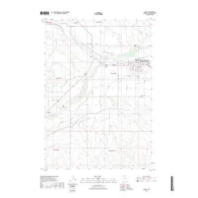
2017 Map of Lovell
USGS Topo · Published 2017About this map
Lovell and the neighboring settlements of Cowley and Byron define the human footprint in this corner of Big Horn County, where the desert landscape has been transformed by a complex irrigation network. The Shoshone River provides the lifeblood for this agricultural effort, feeding an extensive system of waterways including the Lovell Canal, Hunt-Godfrey Canal, and Globe Canal. These engineered channels allow farming to persist alongside dry topographical features like Foster Gulch and Black Draw. Local history is anchored by sites like the Mexican Cem and Lovell Cem, while the northeastern portion of the map transitions into the protected federal lands of the Bighorn Canyon National Recreation Area. The grid-like street plans of the towns contrast sharply with the wandering paths of Sage Creek and Peterson Cr, illustrating the intensive management of water in the Shoshone River valley.
Find a feature on this map
70 named features on this map. Tap any name to fly to it.
Don’t see what you’re looking for? This feature index may not catch every label — zoom into the map to look around manually.
Map Details
Editions of this 2017 Lovell Map
This is the sole edition of this map. No revisions or reprints were ever made.
Other maps of this area

1955 · Cody
USGS Topo · 1:250,000

1958 · Cody
USGS Topo · 1:250,000

1962 · Cody
USGS Topo · 1:250,000

1964 · Lovell Lakes
USGS Topo · 1:24,000

1964 · Sykes Spring
USGS Topo · 1:24,000

1966 · Gilmore Hill NE
USGS Topo · 1:24,000

1966 · North Emblem Reservoir
USGS Topo · 1:24,000

1966 · Frannie
USGS Topo · 1:24,000

1966 · Cowley
USGS Topo · 1:24,000

1966 · Jack Horner Reservoir
USGS Topo · 1:24,000