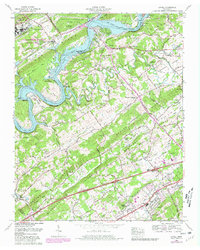
1968 Map of Lovell
USGS Topo · Published 1980About this map
Melton Hill Lake defines the western edge of this landscape, where the Clinch River winds past prominent landforms like Bull Bluff and Melton Hill. The topographic detail reveals a ridge-and-valley system where early settlements and rural infrastructure converged. Key landmarks such as Palace Caverns and Campbell Station are central to the map's historical geography, while institutional sites like the University of Tennessee Agricultural Experiment Station and the US Department of Energy (Oak Ridge Area) occupy significant tracts.
Find a feature on this map
79 named features on this map. Tap any name to fly to it.
Don’t see what you’re looking for? This feature index may not catch every label — zoom into the map to look around manually.
Map Details
Editions of this 1968 Lovell Map
4 editions found
Other maps of this area

1893 · Briceville
USGS Topo · 1:125,000

1895 · Loudon
USGS Topo · 1:125,000

1895 · Briceville
USGS Topo · 1:125,000

1896 · Briceville
USGS Topo · 1:125,000

1935 · Lenoir City
USGS Topo · 1:24,000

1935 · Bethel Valley
USGS Topo · 1:24,000

1935 · Bearden
USGS Topo · 1:24,000

1935 · Lovell
USGS Topo · 1:24,000

1936 · Louisville
USGS Topo · 1:24,000

1936 · Windrock
USGS Topo · 1:24,000