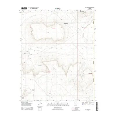
2014 Map of Low Mountain
USGS Topo · Published 2014About this map
Low Mountain and the settlement of Smoke Signal define this high-altitude landscape within the Navajo Nation. The map captures an arid environment shaped by deep drainage systems, where Wind Whistle Canyon and Cienega Canyon cut through the plateau. Several vital water sources are documented here, including Tse Chizzi Spring, Deneziqi Spring, and Coyote Spring, which have historically supported life in this remote part of Arizona.
Find a feature on this map
28 named features on this map. Tap any name to fly to it.
Don’t see what you’re looking for? This feature index may not catch every label — zoom into the map to look around manually.
Map Details
Editions of this 2014 Low Mountain Map
This is the sole edition of this map. No revisions or reprints were ever made.
Other maps of this area

1883 · Marsh Pass
USGS Topo · 1:250,000

1883 · Tusayan
USGS Topo · 1:250,000

1886 · Tusayan
USGS Topo · 1:250,000

1886 · Fort Defiance
USGS Topo · 1:250,000

1892 · Fort Defiance
USGS Topo · 1:250,000

1892 · Marsh Pass
USGS Topo · 1:250,000

1892 · Canyon De Chelly
USGS Topo · 1:250,000

1947 · Flagstaff
USGS Topo · 1:250,000

1954 · Shiprock
USGS Topo · 1:250,000

1954 · Flagstaff
USGS Topo · 1:250,000
Featured Places
- Chinle Agency, AZ
- Fort Defiance Agency
- Low Mountain, Fort Defiance Agency
- Smoke Signal, Chinle Agency
- Navajo County, AZ