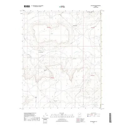
2018 Map of Low Mountain
USGS Topo · Published 2018About this map
Balakai Mesa and Low Mountain dominate this corner of the Navajo Nation, where the high desert plateau is carved by an intricate network of washes and canyons. The 2018 survey reveals a landscape defined by the drainage patterns of Tse Chizzi Wash and Polacca Wash, which slice through the sandstone formations. Key landmarks like Smoke Signal Point overlook a territory sparsely populated but deeply rooted in traditional land use, connected by a system of routes including Indian Route 67 and Indian Route 60. Water remains a vital throughline for the region, marked by named sources such as Denezipi Spring, Hast-clog-toh, and Bighams Lake. The map details the transition from the broader reaches of Keams Canyon in the south to the northern heights near Smoke Signal, capturing the contemporary infrastructure of these ancestral lands.
Find a feature on this map
26 named features on this map. Tap any name to fly to it.
Don’t see what you’re looking for? This feature index may not catch every label — zoom into the map to look around manually.
Map Details
Editions of this 2018 Low Mountain Map
This is the sole edition of this map. No revisions or reprints were ever made.
Other maps of this area

1883 · Marsh Pass
USGS Topo · 1:250,000

1883 · Tusayan
USGS Topo · 1:250,000

1886 · Tusayan
USGS Topo · 1:250,000

1886 · Fort Defiance
USGS Topo · 1:250,000

1892 · Fort Defiance
USGS Topo · 1:250,000

1892 · Marsh Pass
USGS Topo · 1:250,000

1892 · Canyon De Chelly
USGS Topo · 1:250,000

1947 · Flagstaff
USGS Topo · 1:250,000

1954 · Shiprock
USGS Topo · 1:250,000

1954 · Flagstaff
USGS Topo · 1:250,000
Featured Places
- Chinle Agency, AZ
- Fort Defiance Agency
- Low Mountain, Fort Defiance Agency
- Smoke Signal, Chinle Agency
- Navajo County, AZ